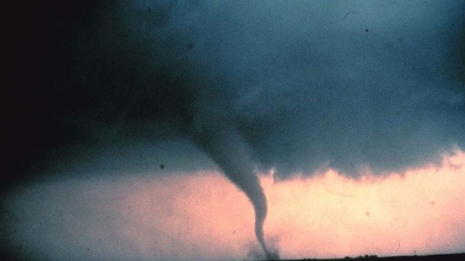

View of the ‘rope’ or decay stage of tornado seen during ‘Sound Chase,’ a joint project of NSSL and Mississippi State University in Cordell, Oklahoma May 22, 1981. (Photo by NOAA Photo Library/Getty Images)
OAN Newsroom
UPDATED 5:21 PM PT – Friday, April 23, 2021
Severe weather tracking towards the Southeast could lead to tornadoes.
The National Weather Service reported on Friday that a low pressure system is forecast to bring thunderstorms to the South Central U.S. tonight, before moving to the Southeast on Saturday.
#Severe thunderstorms are expected on #Saturday across a large portion of the #South and #Southeast. These thunderstorms will likely contain large hail, damaging winds, tornadoes and heavy rain with flooding. pic.twitter.com/QHn19oPSKO
— National Weather Service (@NWS) April 23, 2021
Meteorologists said the moisture flowing in from the Gulf of Mexico combined with the fronts will produce rain and thunderstorms in those regions, with Louisiana and western Mississippi facing a moderate risk of flash floods.
The system expected to bring severe storms across portions of the southern U.S. today/tonight, is also expected to bring heavy rain and the potential for flash flooding.
Avoid water-covered roads. You never know what the road is like beneath dark waters.#TurnAroundDontDrown pic.twitter.com/1BqFTQ8z9P
— National Weather Service (@NWS) April 23, 2021
The Southeast into the Carolinas have a risk for tornadoes, high winds and hail threats on Saturday.
However, the system is set to move out of the South and bring rain showers across the Mid-Atlantic and Northeast on Saturday night.


Be the first to comment