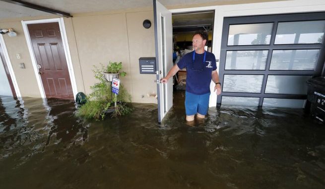

Rudy Horvath walks out of his home, a boathouse in the West End section of New Orleans, as it takes on water a from storm surge in Lake Pontchartrain in advance of Tropical Storm Cristobal, Sunday, June 7, 2020. (AP Photo/Gerald Herbert)
OAN Newsroom
UPDATED 8:07 AM PT — Monday, June 8, 2020
A major storm brought hazardous conditions to states along the northern Gulf Coast. Tropical Storm Cristobal made landfall on Sunday and then moved inland through southeastern Louisiana.
It brought heavy rain, wind and coastal flooding. According to the National Weather Service, Cristobal sustained maximum wind speeds of up to 50 miles-per-hour.
Here’ a clip from our live cam in Mandeville, LA along the north shore of Lake Pontchartrain. We set this one up first, back on Friday night. The run time is about 80 hours and this time, it really paid off since now we can see this impact from #Cristobal. pic.twitter.com/SUiRgbG6vq
— Mark Sudduth (@hurricanetrack) June 8, 2020
Forecasters have predicted the storm will move northward, eventually hitting areas across Arkansas and Missouri. Residents have been warned to stay indoors and stay off the roads. Evacuations are currently underway in parts of Louisiana with storm surge warnings in effect.
“It’s interesting to look how large…I mean, just a very large storm. Any area could get some heavy rainfall. It’s very efficient. Very tropical rainfall. It rains a whole bunch real quick, is really the takeaway here. So you’ve got to be careful out there. Really try to stay off the roads.”
— Ken Graham, Director – National Hurricane Center
Offshore conditions brought a tornado near Orlando, Florida prior to its landfall, which reportedly knocked down power lines and large trees.
Over the weekend, nearby states like Texas prepared for the potential of ‘Cristobal’ crossing into the eastern region.
“Our goal is to deal with what is going to likely be a very heavy rain event in various regions of east Texas and we also wanted to make sure that we’re preparing for potential high wind, especially in the Southeast Texas region,” announced Texas Gov. Greg Abbott (R).


Be the first to comment